


Bougés cerf

asclier0
User
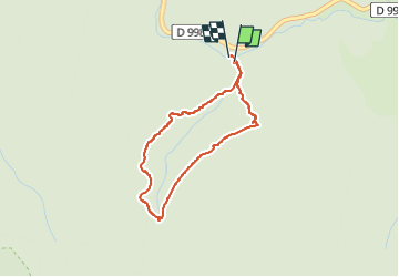

Length
3.2 km

Max alt
1140 m

Uphill gradient
89 m
Km-Effort
4.4 km

Min alt
1047 m

Downhill gradient
93 m
Boucle
Yes
Creation date :
2025-05-29 08:02:52.0
Updated on :
2025-05-29 09:31:21.4
1h08
Difficulty : Easy

FREE GPS app for hiking
 SityTrail
IGN / Geographical institutes
SityTrail Plus
The world is yours!
About
Trail Walking of 3.2 km to be discovered at Occitania, Lozère, Pont de Montvert - Sud Mont Lozère. This trail is proposed by asclier0.
Description
La fois où on a vu le cerf
Positioning
Country:
France
Region :
Occitania
Department/Province :
Lozère
Municipality :
Pont de Montvert - Sud Mont Lozère
Location:
Saint-Maurice-de-Ventalon
Start:(Dec)
Start:(UTM)
563909 ; 4908968 (31T) N.
Comments